 |
Comparación de Mapas de GPS con INEGI INEGI/GPS Maps Compared
|
|
Español Agradecemos a Doug Smith su ayuda en obtener las imágenes de ejemplo correspondientes a Garmin y Mapsource. Puedes ver su web de GPS en
Conforme avanza la tecnología del GPS, la disponibilidad de receptores con mapas integrados es cada vez mayor y a precios más accesibles. Así mismo, los usuarios están demandando este tipo de mapas en sus receptores para sacarles mucho más provecho. La precisión y nivel de detalle de los mapas ofrecidos será un gran factor en su éxito. Hasta ahora cada marca de GPS esta realizando su propio software de mapas, siendo los principales: Garmin
Magellan
Lowrance
La precisión y nivel de detalle de estos mapas varía de zona a zona del mundo, por lo que, aplicados a México podemos decir que: 1. En general los mapas de Garmin tienen más detalle que los de Magellan y Lowrance. Puedes ver ejemplos en estos enlaces: http://jack.finalapproach.net/world-maps.htm http://jack.finalapproach.net/ 2. El detalle de los mapas para México es muy bajo en cualquiera de las tres marcas. 3. Es frecuente encontrar errores en la precisión de los mapas.
A continuación mostramos algunas imágenes de mapas obtenidas del WWBM de Magellan y del WorldMap de Garmin para México y las comparamos con el equivalente de los mapas de INEGI. Los waypoints y tracks que se muestran se tomaron con un GPS Magellan Meridian y se descargaron a WWBM y Oziexplorer. Doug uso Oziexplorer y Mapsource WorldMap. El objetivo de esta comparación no es el de criticar, sino ofrecer información clara que te permita decidir si vale la pena obtener este software, dependiendo también de tus necesidades.
|
English We thank Doug Smith for his help with the Garmin and Mapsource samples images. You can see his GPS website at
As GPS technology grows, the availability of receivers with base maps is greater everyday. At the same time, GPS users are demanding this type of maps to take more advantage from their receivers. The map detail level and accuracy will be key factors for their success. As of today, each GPS manufacturer is developing their own software, the main being: Garmin
Magellan
Lowrance
The detail level and accuracy of these maps varies from one place of the world to another. For Mexico we can say that: 1. It looks like Garmin's maps have more detail than Magellan's and Lowrance's. Samples may be seen in these links: http://jack.finalapproach.net/world-maps.htm http://jack.finalapproach.net/ 2. In general, the detail and accuracy for Mexico are low on the 3 brands. 3. Accuracy errors are found often.
Following we show map images obtained from Magellans WWBM, Garmin's Mapsource and compare them with the equivalent INEGI topo maps. The waypoints and tracks were taken with a Magellan Meridian GPS and downloaded to both MapSend WWBM and Oziexplorer. Doug used Oziexplorer and Mapsource. The idea of this comparison is not to criticize but rather offer clear information to help you decide wheteher to get this software or not, depending on your needs.
|
||
|
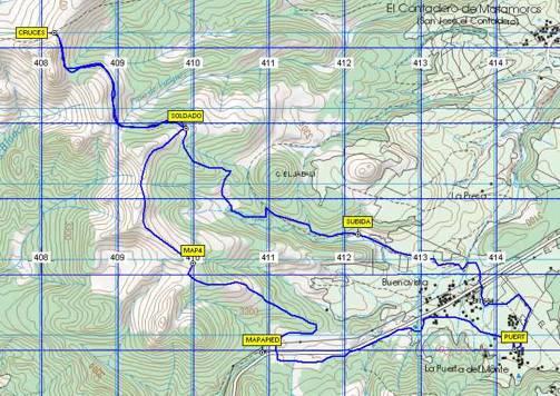
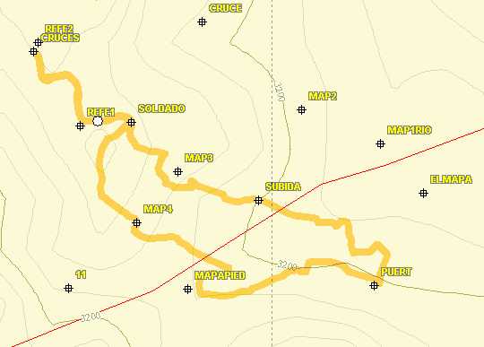
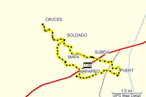
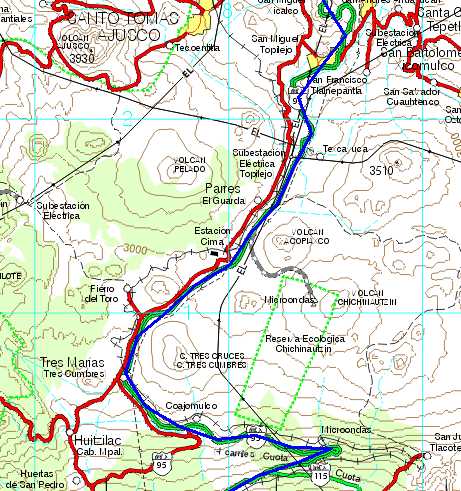
Las imágenes a la derecha comparan mapas de la ruta El Mapa Las Cruces. En la parte superior está el mapa del INEGI escala 1:50,000 creado usando Oziexplorer. En la parte media está el mapa generado con WWBM ajustando la escala a 1:50,000. Y en la parte inferior está el mapa generado con Garmin Mapsource WorldMap, el cual no tiene la opción de curvas de nivel. Se puede notar que tanto en WWBM como en Mapsource la carretera, marcada con la línea roja, esta desplazada hacia el norte respecto al mapa de INEGI. Las curvas de nivel de WWBM solo dan una idea básica del relieve.
The images to the right compare the trail known as El Mapa Las Cruces. On the top we have the INEGI 1:50,000 topo map created with Oziexplorer. In the middle we have the resulting map from WWBM with the scale set up to 1:50,000. And at the bottom we have the Mapsource WorldMap image, which does not have the contour lines option. On both the WWBM and Mapsource WorldMap maps we can see that the highway, in red, is shown farther to the north compared to the INEGI map. Contour lines on the WWBM show very basic land shape.
|
|
||
|
|
|||
|
|
|||
|
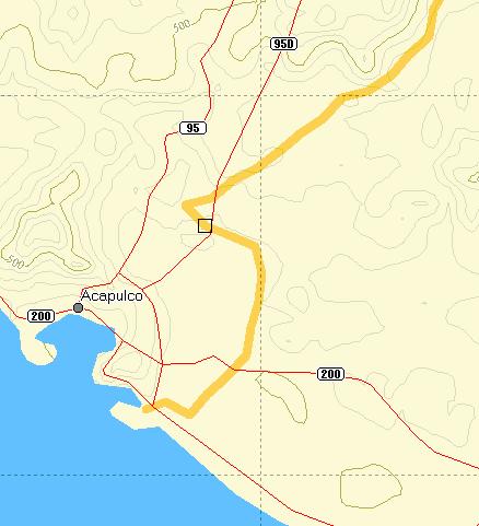
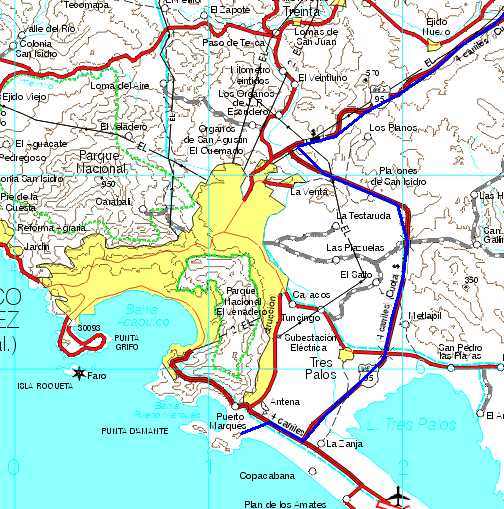
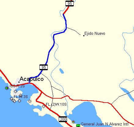
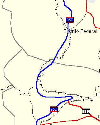
Estas imágenes muestran la zona de Acapulco en escala 1:250,000. En el mapa superior el track muestra la trayectoria de la carretera como la registró el GPS graficada en WWBM. En WWBM la trayetoria de la carretera (95D) está marcada en un rumbo diferente al registrado por el GPS. En la parte media tenemos el mapa de INEGI y las dos trayectorias coinciden. En cuanto a rasgos de terreno, no aparece en WWBM la laguna de Tres Palos. La apariencia de las curvas de nivel es muy parecida en ambos. No tenemos este track sobre Mapsource World Map pero vemos que en él si aparece la laguna, el aeropuerto y varias señalizaciones de faros.
These images show Acapulco, 1:250,000 scale. The map on top created with WWBM shows the track of the highway as recorded by the GPS. The WWBM map has the 95D highway in a different trayectory and does not match with the GPS tarck. At the middle on the INEGI map at right we can see that the highway and the GPS track (in blue) match perfectly. Also we can see that the water body southeast of Acapulco, known as "Laguna de 3 Palos" is not shown on the WWBM map. The contour lines at this scale are very much alike. We did not plot the track on the Mapsource WorldMap at the bottom but we cas see that the lagoon is shown as well as the airport and several lighthouses.
|
|
||
|
|
|||
|
|
|||
|
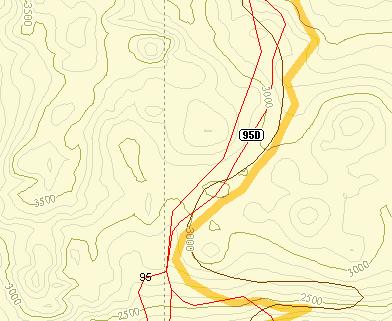
También en escala 1:250,000, en estas imágenes vemos la carretera a Cuernavaca, notándose de igual forma que la trayectoria marcada en WWBM no coincide con el track del GPS. Las curvas de nivel en cambio si son muy aproximadas. En Mapsource no tenemos el track pero podemos ver que la trayectoria de la carretera es muy aproximada a la del mapa de INEGI y los detalles son más claros que en WWBM.
Using the 1:250,000 scale also, we can see the highway to Cuernavaca City south of Mexico City. Again we can see that the highway trajectory is not accurte on the WWBM and that at this scale, the contour lines are very much alike. On the Mapsource map we did not plot the track but we can see that the trayectory of Highway 95D is closer in shape to that of the INEGI Maps and symbols are easier to recognize.
|
|
||
|
|
|||
|
|
|||
|
|
|
|
|
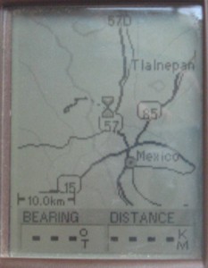
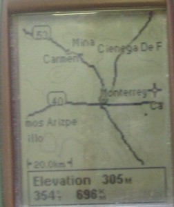
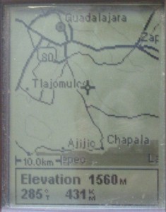
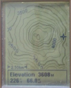
| Estas son imágenes de como se ven estos mapas en la pantalla del GPS Magellan Meridian. Notar que están a diferentes niveles de zoom. |
These are images of how maps are shown on the Magellan Meridian GPS display. Note the different zoom levels.
|
||
|
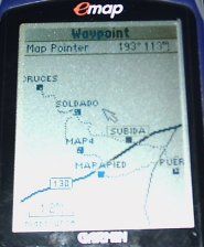
Esta es una imagen de la pantalla del un Garmin Emap mostrando el mapa digital This is a Garmin Emap display showing the digital map.
|
|
||
|
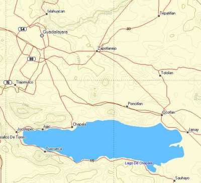
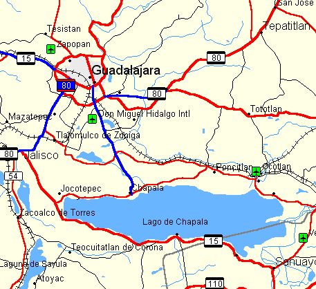
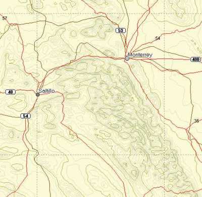
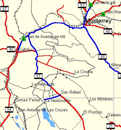
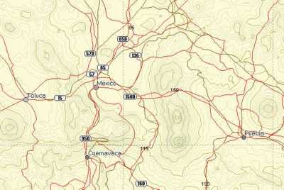
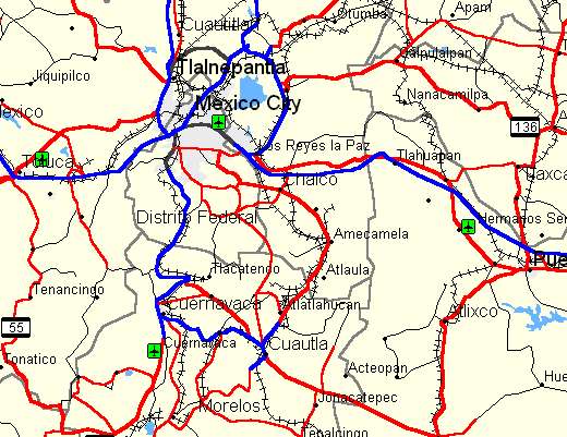
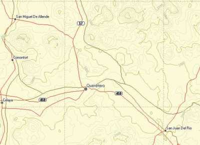
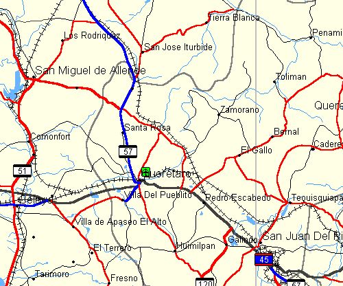
Las siguientes imágenes muestran algunos ejemplos de mapas de diferentes zonas de México obtenidos de WWBM en la columna de la izquierda y de Mapsource WorldMap en la columna de la derecha. The following images show maps for different areas fo Mexico obtained form WWBM, on the left column and Mapsource WorldMap at right. |
|
|
Guadalajara, Jalisco |
|
|
|
|
|
Monterrey, Nuevo León |
|
|
|
|
|
Valle de México |
|
|
|
|
|
Querétaro, Querétaro |
|
|
|
|