 |
|
| MAIN PAGE | |
| INEGI'S MEXICO AERONAUTICAL CHARTS | |
|
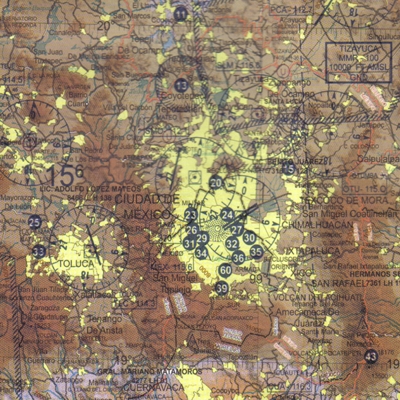
World Aeronautical Chart It is a 12 chart set in 1:1,000,000 scale, printed in 6 double faced bolded sheets titled:
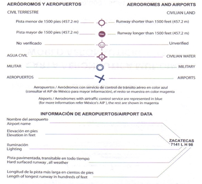
Extended dimensions are 95 cm. wide by 55 cm. high with full national coverage. They provide an adequate media for basic Pilot training and navigation, for pre flight planning, for visual air navigation for medium and small sized aircraft that do not feature a full set of instruments and includes terrestrial zones for civil air navigation based on visual references. It is useful in air navigation only and also as a complement to other navigation forms. It is important to notice that they were issued in the 2006 and 2007 time frame with information gathered between 2005 and 2006. It is an Hypsographic chart with a 6x4 degrees format, except for the Guadalajara-Culiacan Chart that has a 4x7 degrees format, topographic base, air domes data, radio aids, heights, obstacles and runways. It was developed under international norms and as a competitive advantage, INEGI's participation in air flights through Mexico. It can be used for a) A training aid for basic pilot and navigation training b) Pre flight planning and navigation positioning plotting c) Support civil aerial operations that are based on visual references for navigation or, d) As a complement to other navigation methods.
PRICES $ 12.00 USD per chart plus shipping $ 72.00 USD for the full set plus shipping
|
  |