 |
How to Import Mexican DRG maps using Oziexplorer's registered version |
|
Mexican digital topo maps are created as DRG (Digital Raster Graphic). This type of files can be easily imported by Oziexplorer. When you get a Mexican digital map you will receive a CD or a Folder with the Map Number in accordance to INEGI's identification system, for example E14A28. Into this folder you will see several files, all of them starting with the same Map Number but different extensions. Those are (the XXXXX represents the Map Number):
The Import Process Create a folder in the computer hard disk with the number of the map. Copy in it the TIFF, TFW and TXT files. There is no case in copying the GIF and GFW as Oziexplorer does not recognize them. Open the text file and look for the Map Projection and Datum. The following table shows the contents of this file and has the Projection and Datum highlighted in yellow.
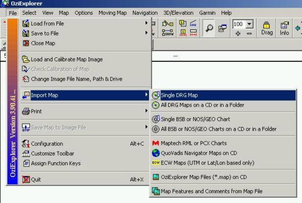
Load Oziexplorer and click on "File/Import Map/Single DRG", as shown below:
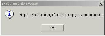
The dialog shown next indicates to look for the image file.
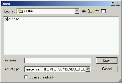
Browse to the folder previously created and select the TIFF file.
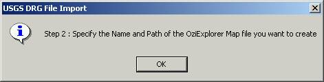
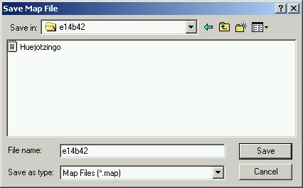
The next dialog will show. Give a name to the map and the path to save it.
I recommend you use the same folder where the INEGI files are stored.
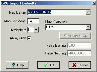
Now the next dialog will show asking for the map's geographic reference information. Remember that INEGI maps may be in NAD27 or ITRF92 Datums. If it is in ITRF92 you should use WGS84 as Oziexplorer does not support ITRF92. The projection and zone will also have to be introduced.
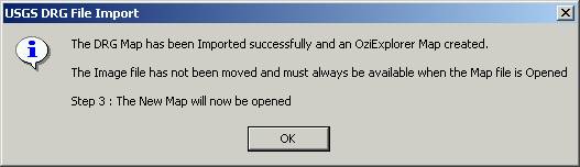
If all is correct, the next dialog will show.
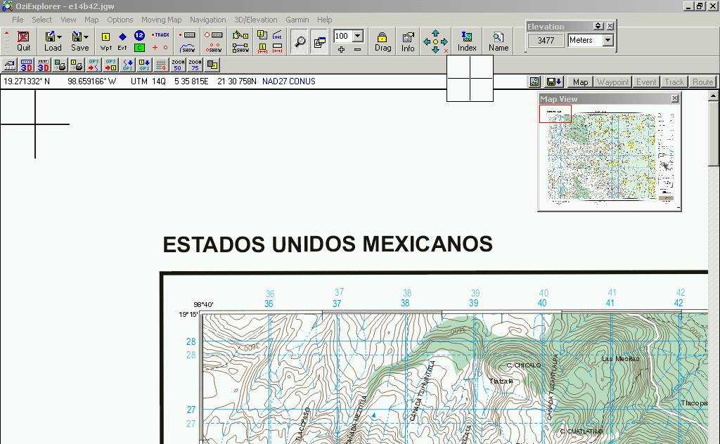
The map is displayed and you can now work on it.
For any question about this process, do not hesitate to contact us. We also strongly recommend that you read Oziexplorer´s Help-
Alberto Nájera August, 2003
|