Main Page
ABOUT MEXICAN TOPOGRAPHIC MAPS    

MEXICAN TOPO MAPS IDENTIFICATION GUIDE IMAGE SAMPLES OZIEXPLORER IMPORT OZIEXPLORER CALIBRATION


Mexican Topographic Maps

Mexican topographic maps are developed by a federal government agency called “Instituto Nacional de Estadística, Geografía e Informática” known as INEGI which stands for Mexican Institute for Statistics, Geography and Information. They have a website, with an English version at www.inegi.gob.mx .

 This is the key information of Mexican topographic maps:

  • Three major scales are available:   1:1,000,000; 1:250,000 and 1:50,000.

  • They used to be in the NAD27 CONUS datum but starting in 1998 a transition to ITRF92 began. To make this change easier, for a while all the maps were published with both datums. The transition is almost over and the maps being produced today are all in ITRF92  but it is likely that for a while you will be able to get maps with both datums.  NOTE: I have not seen yet a GPS unit that handles ITRF92 but it is identical to WGS84 which can be used without concerns.

  • All maps have three coordinate systems printed: Latitude/Longitude; UTM and MGRS.

  • There are paper maps available for the whole country in the 3 scales.

  • The 1:250,000 scale maps for the whole country are also available in Digital Raster Graphic (DRG) files in TIFF and GIF file formats with their respective georreferencing files (TFW and GFW). You can get them all in a set of 4 CDs.

  • The DRG maps in the scale of 1:50,000 are being issued and as of today (August 2008) about 85% of the country is available.. They have the same format characteristics as the 1:250,000 ones.

  • The 1:50,000 maps have shading to help in the terrain contour interpretation.

  • There are vector versions of these maps on both  the 1:50,000 and 1:250,000 scales. For the 1:50,000 they are available for 60% of the  country and for the 1:250,000 the whole territory is available.

  • Digital terrain elevation models (DEMs) in " *. bil" format are available for the whole country. Of interest for outdoor recreational activities are the DEMs based on the  1:250,000 scale maps which has height data based on a 100 meters quadrangle and cost USD $ 75 per chart and the ones based on the 1:50,000 maps that have height data every 50 meters and cost USD $ 65 per chart.


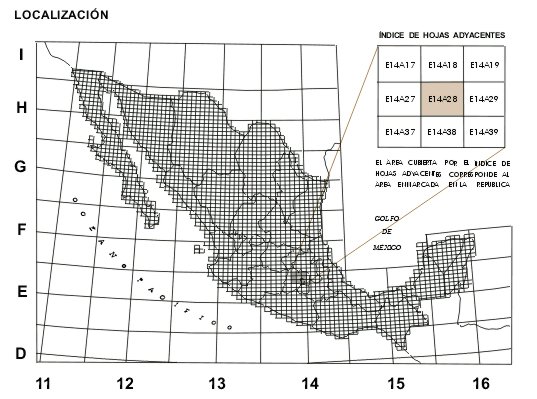
Mexican Topographic Maps Identification Guide

The INEGI service centers provide whatever assistance needed to get the map you want.  We will use the 1:50,000 maps to explain the numbering and naming method used by INEGI. The same concept applies to other scales.

 The whole country is available and there is a Key Map as shown next which allows to locate the zone needed


A grid is placed over the country. The vertical divisions numbered 11 to 16 are the UTM zones in which Mexico lies. The horizontal sections with letters from D to I follow internal INEGI standards. Each of the small squares all over the map  represent a 1:50,000 topographic chart. There are about 2400 to cover all the territory.

The intersection of a vertical division with an horizontal one create a quadrangle which is identified by the combination of the respective section letter and number, like E14.

Within each quadrangle a consecutive numbering system is used to identify each of the maps.  The final identification number is then formed as follows:


Letter of the zone between parallels in which the map is located

Number of the UTM zone between meridians.

Consecutive number

E 14 A28

 The name of a noticeable characteristic within the map is added. In our case it is the town of “Villa del Carbon” so the complete identification of the map is:


E14A28   “Villa del Carbon”

Interactive Topo Map Identification

The following link will take you to a sensitive Mexico Map that will help to find the topo map you are looking for. Just place the mouse on the area of interest, click, and the map numbers of the zone will show:

http://geologia.cicese.mx/sist_inf_geo/ClavesINEGI/Simple.html


MAP IMAGE SAMPLES

This is a section of a 1:250,000 map


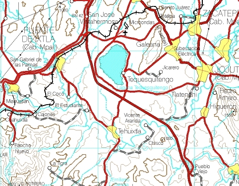
And this on from a 1:50.000 map


Main Page